SUNDAY-MONDAY WINTER STORM
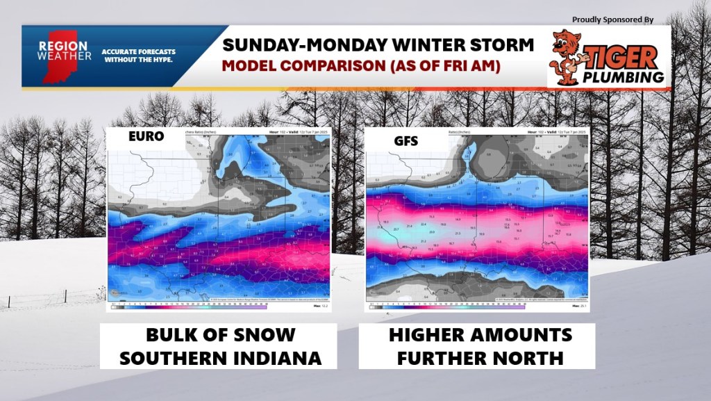
The first big winter storm of the season for the eastern US will develop in the central Plains later Saturday bringing treacherous winter weather to a good portion of the Missouri and Ohio Valleys Sunday into Monday. A swath of heavy snow is expected to the north of the low that looks to set up from Missouri into central and southern Illinois and Indiana. Just south of the snow will be a decent ice storm stretching from southern Illinois and Indiana into Kentucky. This entire storm system coincides with a big travel day across the country as people head back from their holiday time off.
For us locally, I’m not expecting a lot of snow from this as there will be a sharp cutoff on the northern side of that swath of snow. It’s all dependent on the exact track of the low, however, and a slight jog northward would put us in play for accumulating snow. As we talked about last night, I’m expecting lake effect to develop on the backside of this system Sunday night into Monday. This lake effect snow could impact areas of Lake, Porter, and eventually LaPorte counties with several inches of snow Monday. Either way, we need to pay attention to this one. We’ll be keeping a close eye on it and we’ll have another update later this evening in a LIVE broadcast on our Region Weather FB page.