See our previous post for the specific weekend forecast–now it’s time to jump ahead to the active pattern next week!
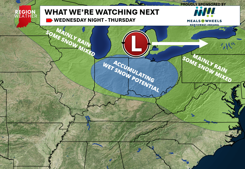
We know it’s coming…but when? Model guidance is coming into further agreement regarding the evolution of next week’s storm systems and overall they look warmer and more rainy than anything else for much of the Midwest. (details still to come) However, our initial low pressure that moves through the Region Wednesday night into Thursday will drag a piece of that cold air into it helping rain to change over to a potentially heavy wet snow for portions of Indiana and Ohio. Again, this would be Wednesday night into Thursday.
Exact placement of where this changeover occurs will be sorted out the next few days but the first snowflakes of the season are certainly possible with some portions of Indiana picking up some accumulating wet snow from this one.
We’ll talk all about this and the next 10-15 days in our bi-weekly Region Weather LIVE broadcast Sunday evening! Enjoy your weekend!