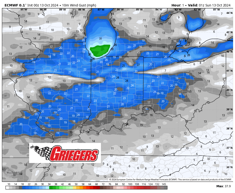
Good Sunday morning everyone! Our rain held off just to our north overnight as the boundary didn’t make it quite as far south as expected. The rain will hold to the north for much of our day today as an area of low pressure will begin to deepen and swirl through the Great Lakes bringing that shot of much cooler air to the Region this week. The cooldown process starts today as wind will start to crank and cooler air will start moving in this evening into tonight. In terms of rain–as we mentioned, most of it held just to our north last night and that will be the case for much of the day until that “swirl” moves in later today into tonight. Lake effect rain still looks VERY likely tonight through much of the day tomorrow with our newfound temps in the 50s Monday. We’ll chat more about this pattern change and look ahead in our Region Weather LIVE broadcast coming up this evening.