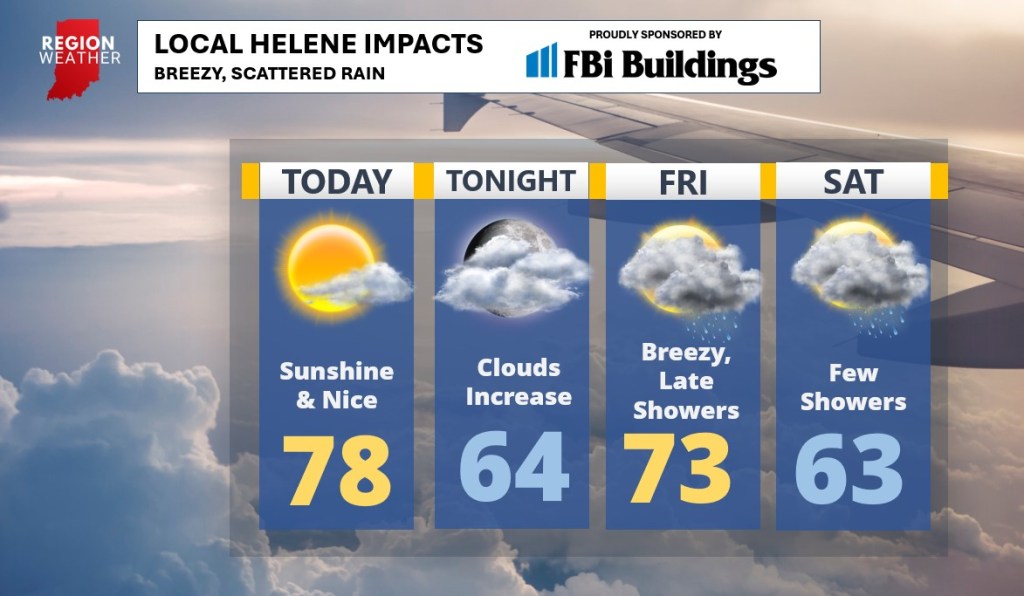
As Helene makes landfall later this evening, the system will quickly move north and “sling” back to the west as it interacts with an upper level low that will quickly weaken the entire system. The result will be increasing high clouds tonight with a few bands of rain moving in here by late Friday. The wind will pick up as well–nothing crazy, but winds could gust over 30mph at times later Friday. Showers will remain scattered this upcoming weekend–I certainly wouldn’t cancel any plans as there will be many dry hours–but keep the umbrella handy as showers will remain around us on radar Sunday too.
Here’s the morning update:
And here are the local impacts I’m expecting here in the Region: