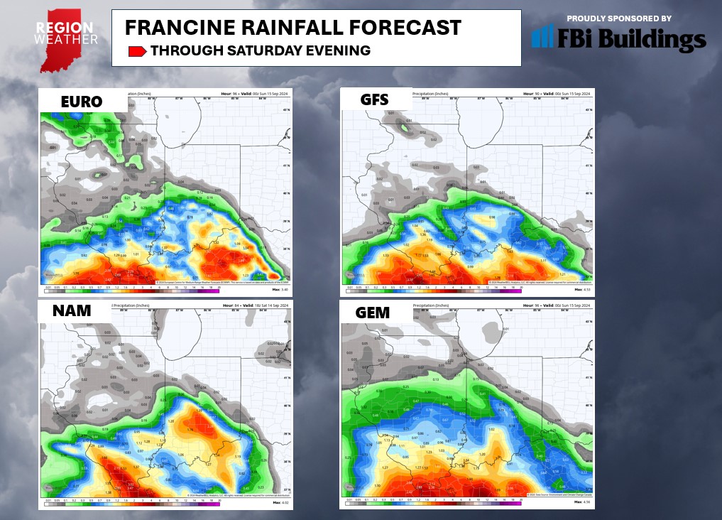
Hurricane Francine will make landfall later today near New Orleans bringing storm surge, flooding rain and strong winds through southern Louisiana. Locally, we’ll have quiet weather today and tomorrow before high clouds off of Francine begin to move in Thursday afternoon. Attention then turns towards how far north the rain from this system makes it into a strong area of high pressure just to our east. Our forecast remains unchanged since last week–it’s just going to be tough to get rainfall this far north into the drier air. We’ll carry a slim shower chance Friday and Saturday as the remnants fizzle to our south. By Sunday, any leftover moisture will then interact with a frontal boundary pushing in, perhaps giving us a better chance for some rain on Sunday–but more relating to the front vs Francine. Either way, we need the rainfall and our chances look slim through Saturday. Take a look at the agreement in model guidance with our forecast: