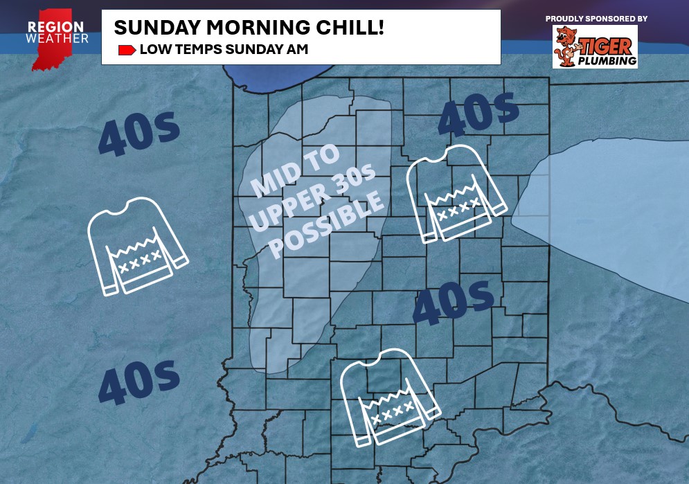
The cold front is through the Region and we’ll see lake effect showers begin to develop today through Saturday. High pressure will then settle in Saturday night providing clear skies and some of the coolest temps we’ve had in months around here. Waking up Sunday morning you can expect temps in the upper 30s to low 40s across the Region with the exception being along the lakeshore where temps will likely hold around 50. Some of those traditionally colder outlying locations may even have a few mid 30s on the board! Patchy frost is possible in the coldest of locations.