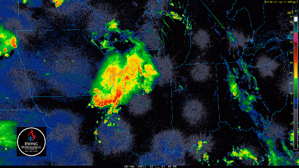
Good Monday morning everyone! If you joined us for our live broadcast last night, everything is going as planned this morning. A large complex of storms continues to sink to the southeast and we’ll deal with some of the leftover rain on the northern end that will be diminishing in coverage. The severe weather threat this morning is zero–just some rain.
Attention then turns towards that “swirl” you see in southern Wisconsin. Depending on how much our atmosphere recovers today (think sunshine, humidity, etc.) we’ll see showers and storms redevelop this afternoon across Indiana–some of which could be strong to severe. I’m still favoring the highest severe weather potential being south of us–but some models indicate it may be close to us. Bottom-line, we’ll have to keep a close eye on the radar later today into this evening and we’ll be doing that for you!