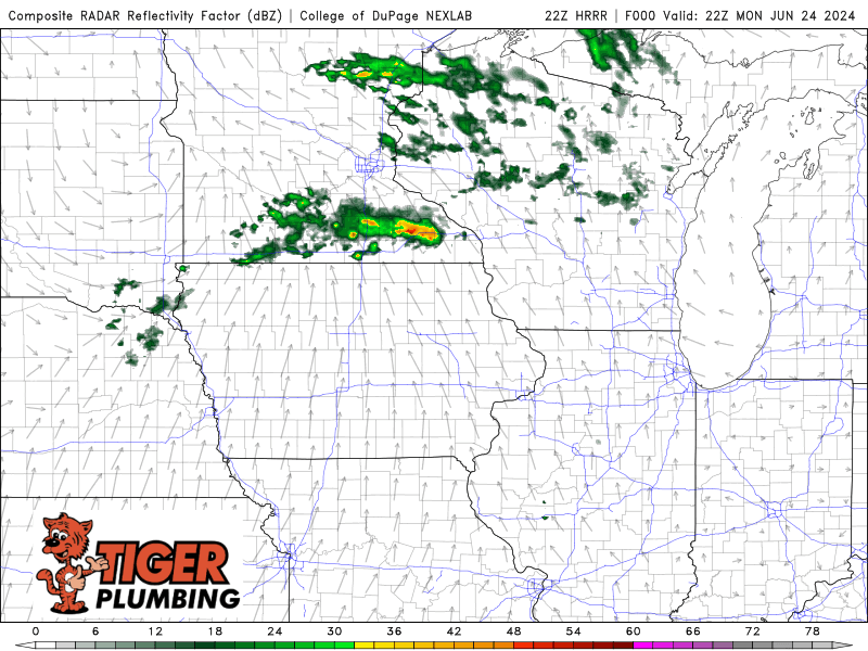
We’re watching a large complex of storms get going in portions of Minnesota this evening as expected on the fringe of a large ridge of heat and instability. This complex of storms is expected to sink southeast overnight towards Wisconsin and Michigan with a path of strong, damaging winds and heavy rain. All indication is that this same complex will head in our direction around the daybreak hours tomorrow. Models are notorious for not handling these systems well in the summer–so confidence isn’t incredibly high in us getting a line of severe storms–but the POTENTIAL certainly is that this complex survives and builds further to the west and the entire thing sinks south. We’re up bright and early tomorrow to track so join us for updates! And get some sleep–we anticipate no severe weather overnight 🙂