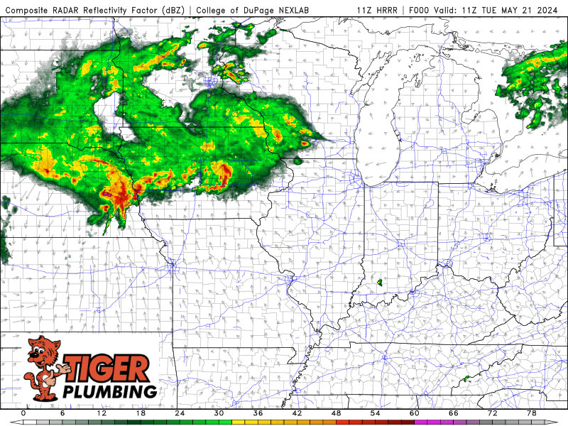
We’re expecting an active day out in Iowa, Illinois, and into Wisconsin later today as a cold front plows into our warm and rather humid airmass. It will be this line of storms that we watch progress eastward towards the Region much later today into tonight. The big question, as it always seems to be, is how well does this line hold together as it moves in? Damaging winds would be the primary risk but this line will be weakening as it moves away from the main forcing and area of energy with this storm system. Something we’ll need to keep a close eye on–but just wanted to give you a heads up that it WILL be an active severe weather evening to our west!