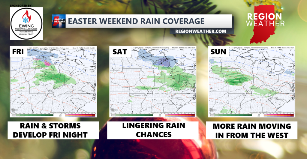
We have a good deal of rain coming our way through the middle of next week with a general “boundary” setting up between warm, spring-like air to our south and colder, winter-like air to the north. We’ll be placed right where these two airmasses meet and will be the recipients of several waves of showers and storms that develop as a result. The first wave looks to develop late Friday into early Saturday with a soaking rain and storm potential. We should get a decent break with many dry hours this weekend, but more rain will be possible as we head through our Easter Sunday and then especially Monday and Tuesday as an area of low pressure gets going with all of this. We’ll keep you updated as we go throughout the weekend!