
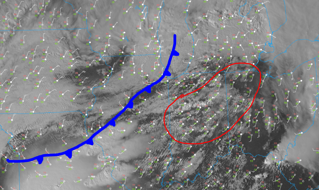
The cold front is sitting JUST to our west with a temp drop from the 60s into the 40s at both O’Hare and Midway within the last hour. The atmosphere has recovered nicely, but storm development is beginning to occur south of us–as we forecasted–and will continue to bring the threat of severe weather JUST south and east of the Region.
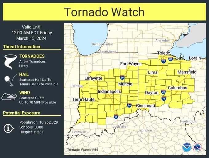
As a result, a Tornado Watch has been issued for much of the state over into Ohio.
Locally, expect temps to drop pretty quickly over the next few hours as colder air sinks south across the lake. We’ll likely see a widespread area of fog roll off the lake as well.
