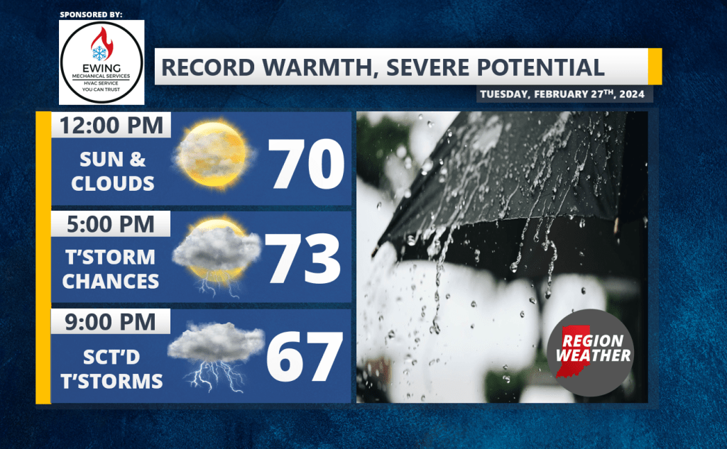
A powerful cold front will make its way towards the Region today bringing a final surge of record-warmth to be followed by a truly impressive temperature crash tonight! In between, we run the risk of strong to severe storms that develop later this afternoon into the evening. I’m still expecting the storms to be scattered–so there’s a chance not everyone sees thunderstorms later tonight. The potential remains for any storms that DO develop to go severe with all modes of severe weather possible. Highs should push the mid 70s today with gusty winds. Strong winds continue tonight and tomorrow blowing in much colder, arctic air. We’ll go from the 60s this evening into the 20s by daybreak Wednesday with feels like temps in the single digits at times. Incredible!
We’ll have updates as needed throughout the day!