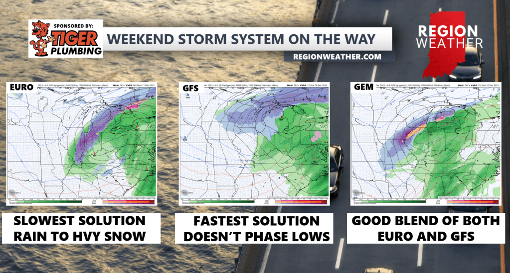
As we talked about in last night’s broadcast, models have good agreement on the potential for a powerful storm system to move through the eastern US next Saturday-Monday. We mentioned that western shift that usually occurs and we absolutely got that today in the modeling–however there is still a TON of variance on strength and track of the low. No sense in getting into the details tonight, but I wanted to show you the main differences right now between the timing and appearance for this system. What we can begin to grow confidence in is that we’ll have a very windy storm with the most likely outcome being a rain to wet snow/wind combination. Timing would be sometime late Saturday through early Monday. We’ll keep you updated as we get a better idea throughout the upcoming days!