UPGRADED SEVERE THREAT THIS EVENING
The Storm Prediction Center has upgraded much of northern Illinois and NW Indiana to the Enhanced Category–or a level 3 out of 5 for severe weather this evening. Please don’t get lost in the specifics of this, the bottom line is there look to be explosive thunderstorms that develop in western Illinois over the next hour or so. We’ll be watching these roll east through northern Illinois and eventually Chicagoland–the big deal here is that they’ll be in an unstable and highly sheared environment so the potential for tornadoes is likely with any storms that develop.
(see our Facebook LIVE discussion from earlier HERE)
For us, we’ll be watching to see what develops as they’ll develop well to our west. We’ll then be tracking this closely towards the Region this evening and as always, will pass long the very latest to you over on our Facebook Page including LIVE broadcasts if needed.
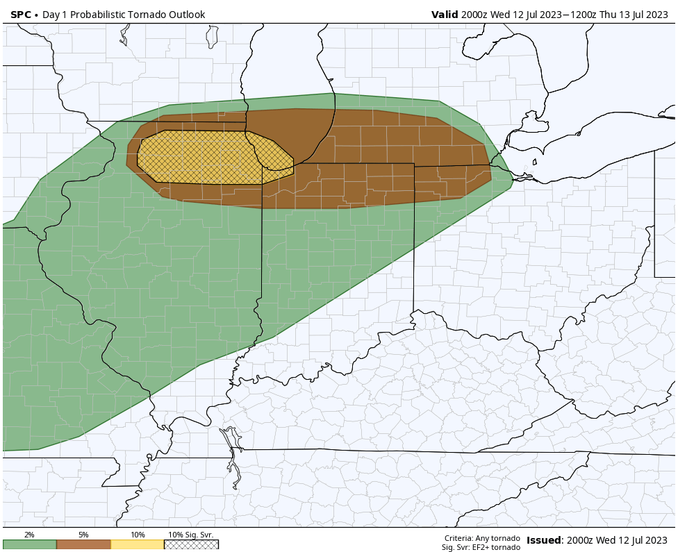
Pictured below is the updated Tornado Risk from the SPC–a rare 10% chance has been issued for northern Illinois into Lake and northern Porter counties.