
**Please check newest updates on our webpage for the latest model runs and our official forecast**
Buckle up, this will be interesting to watch over the next few days as models continue to sort themselves out. The Euro, today alone has gone from:
- A large storm with rain, wind, then snow before it ends. TO
- No storm at all. It had the low developing well northeast of here. TO
- A strong storm again that moves right through the Region bringing rain to heavy snow.
And you’re caught up to the latest forecast! Models have trended disruptively snowier over the last few hours, but keep in mind, it could easily change back as they try to decide exactly where this low will develop and how strong it gets. We’re never about the drama or clicks here at Region Weather–just an informed “heads up” from a degreed meteorologist. So it’s important to stay tuned because tomorrow’s info will be different than todays. Welcome to the world of weather models and forecasting! Let’s take a look.
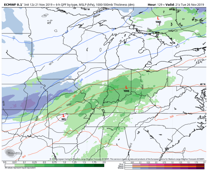
THE EURO
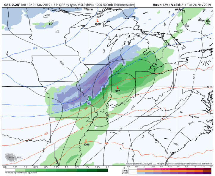
Tuesday afternoon our storm system develops to the south with all rain locally as cold air builds in:
Tuesday night rain changes to a heavy wet snow and if this model holds true, it would be a HEAVY wet snow:
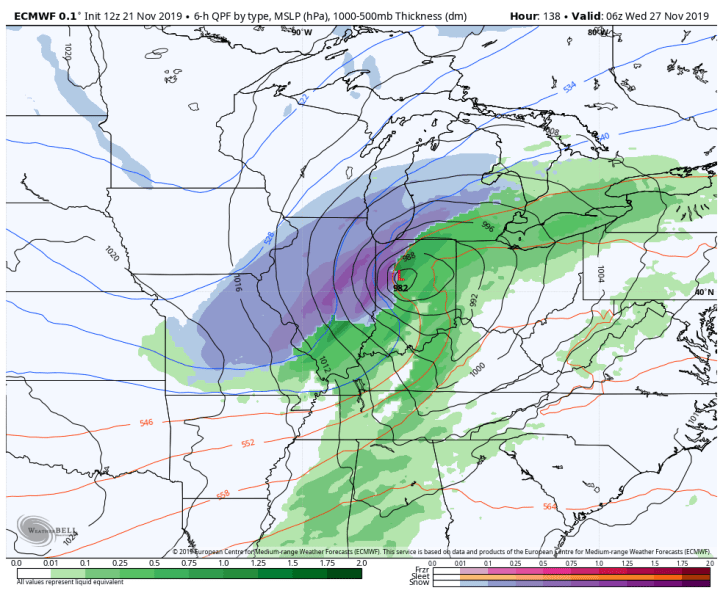
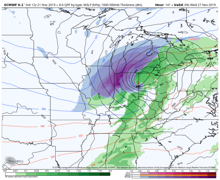
By early Wednesday morning (travel day!) this storm is full-force snowstorm. Look at the heavy snow (with lake enhancement) right over the Region. We’re literally in the bullseye. If you have travel plans Wednesday, you’ll want to hope that this model changes!
By Wednesday afternoon the storm is quickly out of here, but we’re left with wind and a fresh snowpack and likely impacted travel. 
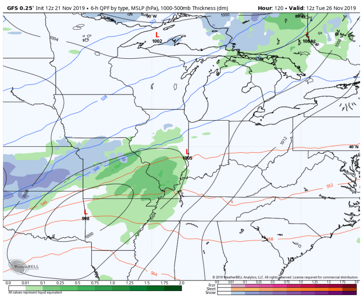
THE GFS MODEL
Tuesday morning is when the GFS has our storm getting going to our south:
By Tuesday afternoon we’re already feeling impacts, but it’s all rain with heavy wet snow in Illinois. Obviously the GFS is quicker and doesn’t give us enough time to cool for the rain to change to snow.
By Tuesday night into early Wednesday morning we’ve changed to a heavy wet snow with a mix to our south:

And finally this storm is out of here before most of us wake up Wednesday morning. This would be the best option…just saying!

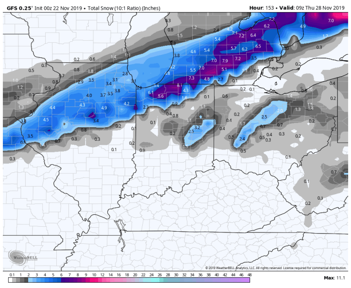
LATEST SNOWFALL POTENTIALS
Here is the evolution of the GFS today. It started out a few inches of snow in more of a southwest to northeast orientation:

Then it brought in a much weaker storm with very light snow amounts:
And now it’s back to a snowier solution with a slightly different trajectory:
And then there’s the Euro–currently our snowiest solution. This would be trouble Wednesday, especially early in the day if it were to verify:
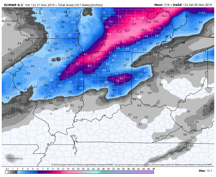
How does an 8-12 inch snowfall sound on the busiest travel day of the year?
That’s why we’ll be keeping a close eye on this one–still 6 days out, but grab a seat because it’s model watch time for a few more days…
